Skip to content
Atacama Deserts
Piedras Rojas (Salar de Aguas Calientes), Atacama Desert, Chile
Salt flatModerate

Piedras Rojas (Salar de Aguas Calientes)

Independently researched — no operator sponsorshipsEntry fees, opening rules and transfer times checked against official sources (list below).

Distance

120 km

Drive time

2 h

Altitude

4,145 m

Entry fee

CLP 15.000

Best time

Midday window (11:00-14:00) on the loop, after acclimatization

Time needed

Full day as part of the salar loop

What it is

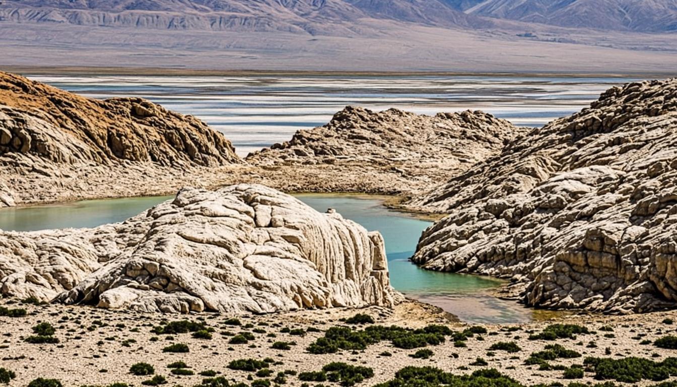
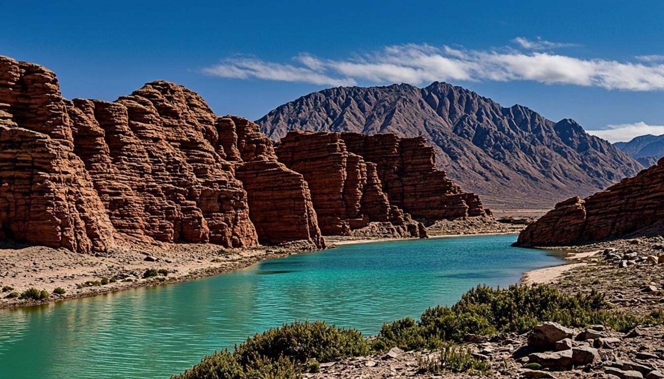
Where the Salar de Aguas Calientes pinches between volcanic ridges, oxidation has painted the rock a deep rust red, and erosion has balanced slabs into mushroom-like formations above a shallow, milk-blue lagoon. The contrast — red stone, white salt, thin turquoise water, black volcanic cones on the skyline — is why this 4,145-m corner became the region's second-most-photographed natural site after Moon Valley.

Status matters here: the sector closed in 2023 for trail regeneration, and reopening has come in phases — sometimes limiting visitors to the upper viewpoint rather than the lakeshore path. Operators restructure the loop accordingly, and the viewpoint is arguably the better frame anyway. The site pairs structurally with the Lagunas Altiplánicas in one big altiplano day; check current access before booking anything.

Why go

  • The most surreal color palette in the region: red rock, white salt, milky lagoon.

  • The anchor of the full-day salar loop that covers the altiplano's greatest hits.

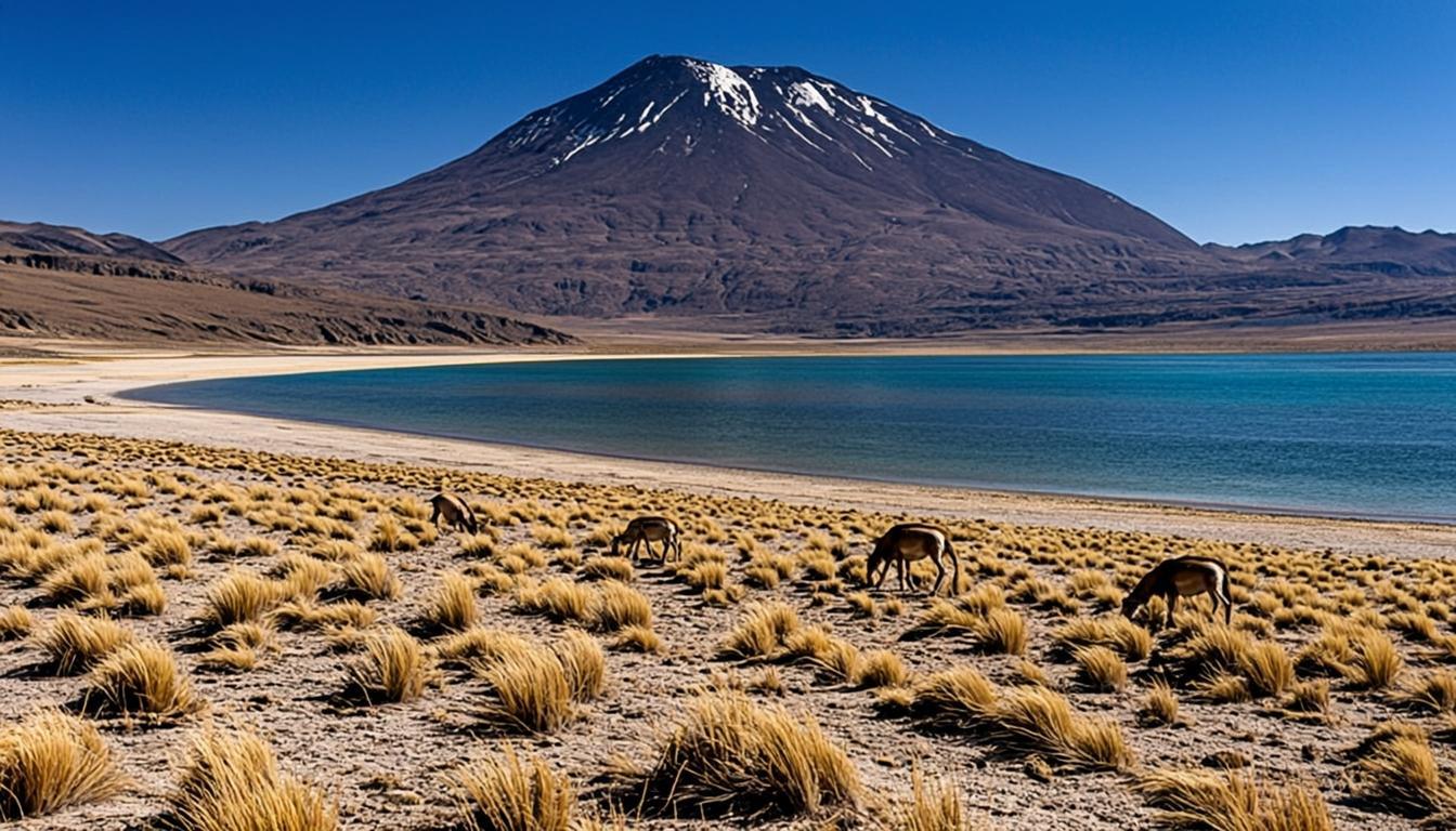
  • Vicuña country — the red rocks photograph with wildlife in frame.

  • A measurable altitude test: if the 4,145-m walk feels easy, Tara is next.

Visiting Piedras Rojas (Salar de Aguas Calientes)

How to get there

It is 120 km and roughly two hours from San Pedro via Socaire and gravel altiplano roads — standard sedan territory in dry season, impassable after storms. The sensible format is the full-day loop tour that sequences Piedras Rojas, Miscanti-Miñiques and Chaxa; self-driving works but splits your attention at altitude on a long day. Socaire is the last fuel-and-food stop for hours.

  • If the sector is closed, operators substitute Monjes de la Pacana or other Tara-sector stops.

  • Check your rental car's gravel-road coverage before pointing it up Ruta 23.

When to go & what to expect

Loop tours arrive late morning through early afternoon, the calmest wind window at this height. Expect thin air: the short shoreline walk, when open, leaves most visitors breathing noticeably harder. Weather flips fast — sun, then hail squalls within an hour in summer. Access level (shoreline vs viewpoint) is set by the community and CONAF and changes seasonally; ask your operator 48 hours out.

Rules & practical tips

Where shoreline access is allowed, stay on the marked trail — regeneration zones are fenced and monitored. No swimming, no drones, no climbing on the formations. Cash gate fee, basic toilets, no food services. Two full days in San Pedro before this trip is the honest minimum; the altitude guide explains the acclimatization math and the packing list covers the wind-and-cold kit.

Book the loop, not the single stop: Piedras Rojas' 240-km round trip only makes sense chained with the lagoons — and verify current access before paying.

Common mistakes (and how to avoid them)

Piedras Rojas has more moving parts than any other stop on the classic loop: a phased reopening since 2023, community gate rules, 4,145 m of altitude and summer storms. Treat the mistake list as a verification list.

  • Booking without confirming access: since the 2023 closure the sector has swung between shoreline paths, viewpoint-only visits and full closure. Reputable operators confirm 48 hours out; a seller who cannot answer is a red flag.

  • Scheduling it for day one or two: at 4,145 m after a 4,400-m pass, unacclimatized visitors spend the stop managing nausea instead of photographing red rock.

  • Assuming any rental car works: the altiplano gravel is impassable after storms and some contracts exclude it — check coverage before pointing the car up Ruta 23.

  • Climbing on the formations or over the fenced regeneration zones: the balanced slabs are protected, monitored and fined. The path view is the one everyone wants anyway.

Piedras Rojas is a verify-before-you-book destination: current access, weather window and acclimatization all have to line up before the stop delivers.

Piedras Rojas (Salar de Aguas Calientes) on the map — and the services around it

The orange pin marks Piedras Rojas (Salar de Aguas Calientes) (120 km from San Pedro, about 2 h by van). Every other marker is a real service — and every marker has its own page: tap a place to open it, or add it straight to My Atacama Map. Useful if you are self-guiding or planning a stop on the way back to town.

  • Landmarks & ruins
  • Carabineros (police)
  • Health & pharmacy
  • ATMs & exchange
  • Fuel station
  • Transport
  • Tourist info & CONAF

Positions are approximate and meant for orientation — follow the official park signs on site.

Services, food & stays nearby — open a place, add it to your map

The 10 closest places to Piedras Rojas (Salar de Aguas Calientes), sorted by distance: tap a name to open its own page, or pin it straight to My Atacama Map without leaving this one.

  • Control Carabineros Ruta 23 (Socaire)

    Carabineros (police) · Ruta 23, km ~90 toward Salar de Tara / Argentina pass

    33.7 km from Piedras Rojas (Salar de Aguas Calientes)

    Checkpoint on the high route. Self-drivers heading to Salar de Tara or the Sico pass may be asked for documents — carry passports and car papers. Also the informal "road open?" info point.

    Details →
  • Posta de Salud Rural San Pedro de Atacama

    Health & pharmacy · Calle Gustavo Le Paige, a 2 cuadras de la plaza

    67.5 km from Piedras Rojas (Salar de Aguas Calientes)

    Primary care and 24/7 emergency stabilization. Serious cases are stabilized here and transferred to Calama by ambulance (131). Bring your passport and travel insurance details.

    Details →
  • Farmacias Cruz Verde

    Health & pharmacy · Esquina Caracoles / Toconao 359

    67.5 km from Piedras Rojas (Salar de Aguas Calientes)

    The chain pharmacy, a block from the square: the safer bet for anything the local pharmacy does not stock. Google Maps rates it 3.5 from 129 reviews — the rating is low, the range is not.

    Details →
  • BancoEstado ATM (Caracoles)

    ATMs & exchange · Calle Caracoles, frente a la plaza

    67.5 km from Piedras Rojas (Salar de Aguas Calientes)

    The main bank ATM cluster — and the one most likely to run dry on weekends and holidays. Withdraw CLP in the morning; card fees apply per withdrawal, not a %.

    Details →
  • Oficina de Información Turística (Municipal)

    Tourist info & CONAF · Calle Toqui, a un costado de la plaza

    67.5 km from Piedras Rojas (Salar de Aguas Calientes)

    Free official maps, current road status (which attractions are closed after rain), and licensed-guide lists. The best source for "is the Tara road open today?" before you book.

    Details →
  • Farmacia Vizcacha

    Health & pharmacy · Vilama 425, esquina de la plaza

    67.6 km from Piedras Rojas (Salar de Aguas Calientes)

    The pharmacy on the corner by the square: painkillers, rehydration salts, sunscreen, motion-sickness pills, and the coca tea and sorojchi pills sold locally. Google Maps rates it 4.3 from 23 reviews. Stock is small and hours irregular — bring prescription meds from home.

    Details →
  • Global55 / MultiCaja ATM

    ATMs & exchange · Calle Caracoles (segunda cuadra)

    67.6 km from Piedras Rojas (Salar de Aguas Calientes)

    Independent ATM network — works when BancoEstado does not, but charges a higher fixed fee per withdrawal. Useful backup, not the first choice.

    Details →
  • Casa de cambio (centro)

    ATMs & exchange · Calle Caracoles / Toqui, centro

    67.6 km from Piedras Rojas (Salar de Aguas Calientes)

    Cash exchange for USD/EUR/BRL to CLP. Rates are noticeably worse than city banks — change only what you need for entry fees and markets; cards work almost everywhere in town.

    Details →
  • Terminal de Buses San Pedro de Atacama

    Transport · Calle Jerónimo de Almagro, entrada sur del pueblo

    67.6 km from Piedras Rojas (Salar de Aguas Calientes)

    Buses to Calama (~2 h, ~CLP 3.500–5.000, several daily) plus long-haul to Salta and Jujuy (Argentina) and Antofagasta. Buy tickets a day ahead in high season; no online seat picks.

    Details →
  • CONAF — Reserva Nacional Los Flamencos

    Tourist info & CONAF · Centro, cerca de la plaza

    67.6 km from Piedras Rojas (Salar de Aguas Calientes)

    Park service office for the national reserve (Valle de la Luna, Chaxa, Tara, Miscanti). Confirms entry fees, trail openings and conservation rules — useful if you are self-guiding.

    Details →

Distances are straight-line — real driving distance can be longer.

Frequently asked questions

Sources & verification

The official references we used while researching Piedras Rojas (Salar de Aguas Calientes): park rules, fees, safety and transport. Everything on this page is written independently — no operator pays for coverage here.

External links open in a new tab and lead to official Spanish-language pages. Fees and access rules can change seasonally — confirm on site or by phone before you travel.
Book Piedras Rojas (Salar de Aguas Calientes)

This link goes to the provider. Once the affiliate programme is approved it will carry our own tracking; for now it goes straight through.

Check availability

Independent editorial. We may earn a commission when you book through a link on this page — it never changes what we recommend.

Verified operators

Tours to Piedras Rojas (Salar de Aguas Calientes)

Piedras Rojas, Altiplanic Lagoons & Salar de Atacama — tour photo, San Pedro de Atacama Full day · ~12 h

Piedras Rojas, Altiplanic Lagoons & Salar de Atacama

US$ 86
Check availability

Entry fees are charged separately at the gate and are usually not included in tour prices.

Lagunas Altiplánicas (Miscanti & Miñiques), Atacama Desert, Chile

Lagunas Altiplánicas (Miscanti & Miñiques)

105 km · 1 h 45 min · 4,140 m

Salar de Tara, Atacama Desert, Chile

Salar de Tara

115 km · 2 h 10 min · 4,300 m

Laguna Chaxa, Atacama Desert, Chile

Laguna Chaxa

56 km · 55 min · 2,305 m

Altitude Sickness in San Pedro de Atacama: Prevention and Protocol — guide cover, Atacama Desert10 min read

Altitude Sickness in San Pedro de Atacama: Prevention and Protocol

How to acclimatize in 36–48 hours, which symptoms actually matter, and which tours to save for day three.

Atacama Packing List: What to Pack for San Pedro de Atacama — guide cover, Atacama Desert9 min read

Atacama Packing List: What to Pack for San Pedro de Atacama

A packing list built from what actually gets used in Atacama — sun kit, layers, night gear, and what to leave home.

The Best Time to Visit San Pedro de Atacama (Month by Month) — guide cover, Atacama Desert11 min read

The Best Time to Visit San Pedro de Atacama (Month by Month)

Month by month: temperatures, rain, crowds, road closures and the Milky Way calendar for San Pedro de Atacama.