What it is
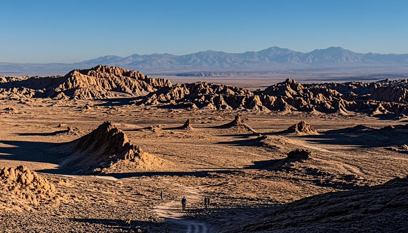
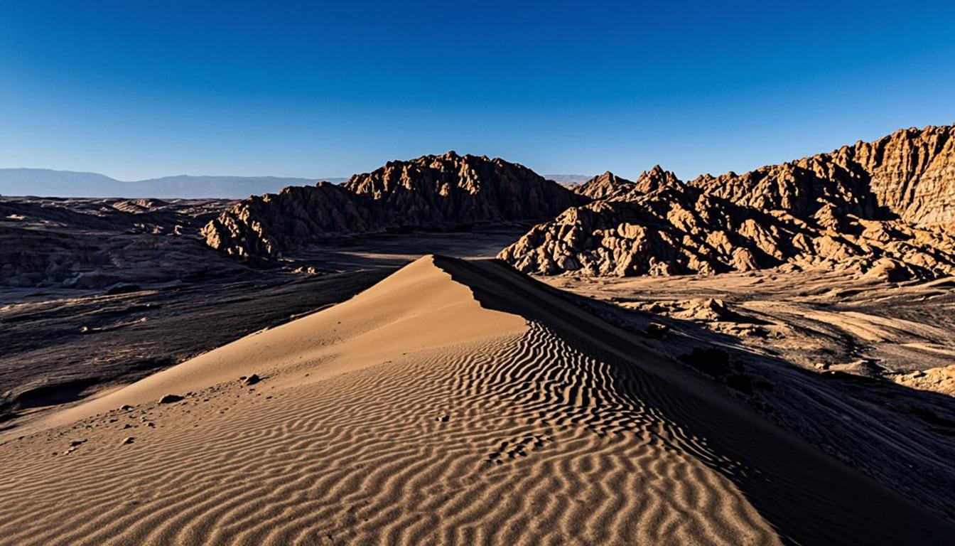
Despite the ominous name — most historians trace it to a garbled "Valle de Marte" (Mars) — this is the friendliest big landscape in the Atacama. A single dirt road climbs into the Cordillera de la Sal and deposits you on a ridge between dunes and carved salt walls, with the snow line of the Andes visible far east. It shares its geology with Valle de la Luna but compresses it into a stop you can walk in half an hour.
Two things define a visit. First, the dune: a steep golden slope where sandboarding outfitters gather every afternoon, renting boards for a few thousand pesos and teaching basic heel-side slides. Second, the light: the ridge faces west, so the last hour turns the salt walls amber while the Andes hold their own glow. Most first-day plans slot it here on purpose — low effort, big payoff, back in town for dinner.
Why go
Fifteen minutes from the town center — the easiest serious landscape in the Atacama.
Sandboarding a big golden dune with the Andes as backdrop; boards rent in town or on site.
Quieter and cheaper than Moon Valley: CLP 5,000 and rarely any capacity queue.
Perfect day one: low altitude, low effort, and easy on the wallet per the budget guide.
Visiting Valle de la Muerte (Valley of Death)
How to get there
Follow Caracoles street west; it becomes the road through the Cordillera pass. By bike it is 20-30 minutes with one sharp climb; by taxi or transfer, agree a round-trip price (CLP 15,000-25,000) because rides back are scarce after dark. Sandboarding tours bundle transport, board and instruction, and typically combine the valley with a Valle de la Luna sunset circuit.
Entry ticket: CLP 5,000 cash at the gate; carry small bills.
Sunset parking fills by 18:30 in high season — arrive with margin.
Rent the board in town before 16:00 (CLP 5,000-8,000/day); on-site rental disappears exactly at golden hour.
When to go & what to expect
Mid-afternoon is best for sandboarding — soft light, waxed boards, warm slopes — while sunset is best for photography. Expect wind from 17:00, and sand at speed is exfoliating: closed sunglasses and a buff matter. The main walk is a flat 15-minute loop along the ridge with two signed overlooks; you can step beyond it, but the crust breaks easily, so walk on sand only.
Rules & practical tips
No drones, no pets, no campfires — the salt crust is protected habitat and rangers do patrol. Pack out everything; there are no bins past the gate. If you are self-driving, note the exit gate closes shortly after sunset and the road back through the pass is unlit, so drive out before full dark or wait for moonlight. The desert packing list covers the wind-and-sun kit that makes the hour comfortable.
Common mistakes (and how to avoid them)
Muerte is the simplest big landscape near town, which is exactly why people treat it casually. The gate, the light and the board rental all run on separate schedules, and there is nobody on site to rescue a bad plan.
Assuming one ticket covers both valleys: Luna and Muerte have separate gates and separate fees — CLP 5,000 here in cash, even if you paid CLP 12,000 at Moon Valley an hour earlier.
Saving sandboarding for sunset: boards, wax and instructors vanish right at golden hour. Ride in the mid-afternoon, then put the camera on the ridge for the last hour of light.
Paying a taxi one-way: return rides are scarce after dark. Agree the round trip (CLP 15,000-25,000) and a pickup time before the driver leaves town.
Biking back after full dark: the pass road is unlit and cold, and rental bikes carry weak lights. Start home before sunset or swap the bike for a transfer.
Treat Muerte as two visits in one — boards in the afternoon, camera at golden hour — and never count on services at the gate for either.
Valle de la Muerte (Valley of Death) on the map — and the services around it
The orange pin marks Valle de la Muerte (Valley of Death) (8 km from San Pedro, about 15 min by van). Every other marker is a real service — and every marker has its own page: tap a place to open it, or add it straight to My Atacama Map. Useful if you are self-guiding or planning a stop on the way back to town.
- Landmarks & ruins
- Health & pharmacy
- Carabineros (police)
- ATMs & exchange
- Fuel station
- Transport
- Tourist info & CONAF
- Markets & shops
- Food & cafés
Positions are approximate and meant for orientation — follow the official park signs on site.
Services, food & stays nearby — open a place, add it to your map
The 10 closest places to Valle de la Muerte (Valley of Death), sorted by distance: tap a name to open its own page, or pin it straight to My Atacama Map without leaving this one.
Distances are straight-line — real driving distance can be longer.
Frequently asked questions
Sources & verification
The official references we used while researching Valle de la Muerte (Valley of Death): park rules, fees, safety and transport. Everything on this page is written independently — no operator pays for coverage here.
- CONAF — park regulations and fee context for the Cordillera de la Sal sectors of Reserva Nacional Los Flamencos
- SERNATUR — official tourism information for San Pedro de Atacama and its surrounding valleys
- chile.travel — official destination profile of the Atacama Desert and its salt formations
External links open in a new tab and lead to official Spanish-language pages. Fees and access rules can change seasonally — confirm on site or by phone before you travel.